Vintage 1950s School Pulldown Map Display Case
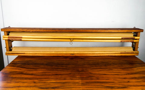
Original vintage 1950's school pull down maps in original schoolroom mounting case. Dating to 1951, 52 and 53 these educational maps were published by Denoyer Geppert. They represent the Ancient world, ancient Orient and Palestine, the Roman Empire and Ancient Greece and finally Napoleon and the Holy Roman Empire. There actually 2 maps on each pull down making it a total of 6 maps altogether. There is also space for another map of the same size in the last space available.
Map: B1 B2
B5 B16
H15 H3
This would make a great addition to any vintage map or education collection. This would make a great early birthday or Fathers day gift.
MEASUREMENTS
Map case measures 48.5" long by 10" wide by 4" thick and weighs 15lbs 1oz. Each pull down measures 62" long by 44"wide.
CONDITION
In good condition and ready to hang with good condition throughout (please see all pictures as they form part of the condition description).
Click Here to see our shipping, returns and refunds policy
Feel free to contact us if you have any further questions about this item.
We Also Recommend


